


Bankstown Airport Southeast VFR Corridor
CASA, in consultation with Airservices Australia, has announced a proposal to reclassify a portion of airspace southeast of Bankstown Airport to uncontrolled airspace and create a southeast corridor for use by all aircraft flying under Visual Flight Rules (VFR), up to 1500ft.
The proposed Class G corridor is in response to the constrained nature of airspace in the Bankstown area and growth in air traffic in the Sydney Basin – which will be exacerbated by the commencement of Western Sydney International Airport.
The Southeast VFR Corridor is intended to:
- Reduce airspace risks associated with the constrained nature of the Bankstown control zone and sustained growth in air traffic in the region;
- Provide better access to Sydney flight training areas; and
- Provide equitable and efficient access for airspace users.
CASA is preparing the Airspace Change Proposal (ACP), which will:
- Reclassify a section of the Sydney CTR, located south and southeast of the Bankstown CTR, to create a Class G corridor from surface to 1500ft above mean sea level
- Introduce two one-way daytime-only VFR lanes within the proposed corridor.
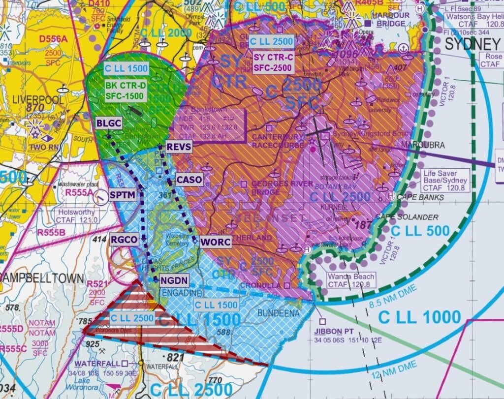
Proposed corridor design
The proposed changes to the Sydney CTR are highlighted in blue on the map below. The map also shows the proposed waypoints and VFR lanes (dotted lines) – the outbound lane is on the right and the inbound lane on the left.
Submissions to the proposal
CASA and Airservices Australia are seeking industry and community feedback to the proposal. Submissions close 22 October 2024.
Submissions and feedback may be provided via the CASA or Airservices websites, by clicking on the links below.
For more information or to lodge a submission:
- Airservices Australia engagement webpage: https://engage.airservicesaustralia.com/bk-vfr
- CASA consultation hub: https://consultation.casa.gov.au/stakeholder-engagement-group/bankstown-airport-southeast-vfr-corridor/